![]()
SIMULATOR-ADS (ModULAr Integrated System for Risk Management and Prevention – Enriched with Satellite Data) is an innovative platform and decision support tool (DSS) for local public administrations (PAs) aimed at Civil Protection 2.0. This tool was designed to meet the real needs of safeguarding the population, protecting the territory, in particular services, activities and environmental assets, and optimising regional infrastructure systems. The system is implemented for the management of risks due to natural causes, including mostly extreme hydrometeorological and seismic events, or anthropogenic causes such as technological and chemical/industrial accidents. The application was developed within the project of the same name, funded by the Lombardy Region.

SIMULATOR-ADS has led to an improvement in the existing functionalities of the SIMULATOR project (based on feedback from the stakeholders involved in the project), integrating and thus making available to local authorities a wider range of both risk management procedures and heterogeneous, static and dynamic, real-time and/or near-real-time multi-source information relating to the territory of competence.
Product functionality
The SIMULATOR-ADS tool is an advanced WebGIS platform that integrates information from remote sensing image processing, acquired through the Copernicus Sentinel Data Hub, and reports directly from the territory, in real time, by practitioners, volunteers and informed citizens, acquired through smart-apps. The tool allows for a combination of heterogeneous and up-to-date information useful for emergency management and risk assessment.
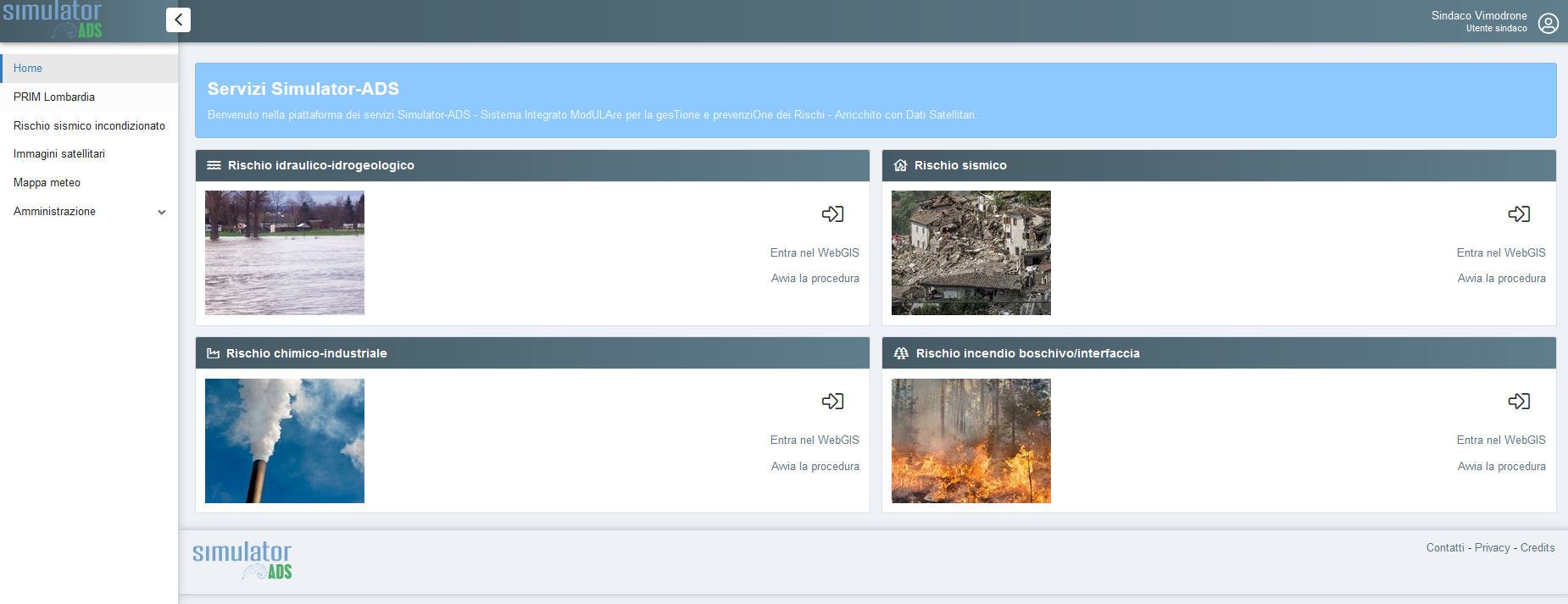
In particular, SIMULATOR-ADS allows you to view and use:
- Risk scenarios, represented by thematic maps derived from institutional sources (such as basin authorities or functional centres) or scientific studies and research. These scenarios provide an up-to-date picture of the vulnerabilities and potential criticalities present in the territory.
- Up-to-date meteorological data, including short and medium term forecasts, essential for monitoring the evolution of weather conditions and supporting decision-making in the event warning or management phase.
- Operational procedures designed for risk management, including hydrogeological and hydraulic phenomena, chemical-industrial accidents, forest or interface fires, and seismic events. These procedures are managed through an internal operating module, which allows them to be adapted to the specific context of the emergency.
- Reports from the field, acquired through an intelligent mobile application that allows the two-way and real-time exchange of information between field operators and decision makers, operating in the municipal operational centers or in supra-municipal coordination structures. The information collected may include images, video, audio files and text data, useful for a quick situational assessment.
Downstream satellite analysis services, which enable the periodic and automated mapping of areas affected by extreme events such as floods or forest fires, using high-resolution data from the Sentinel satellites of the European Copernicus programme.
These services make it possible to trace the extent of damage and its impact on the territory. SIMULATOR-ADS in fact allows the acquisition of “dynamic” temporal information and data display in the cartographic engine so that the user can evaluate the areas of actual damage derived from satellite information after the event.
The web platform
The application has been designed to enable effective two-way communication. On the one hand it allows emergency managers to send information to field operators, on the other hand it allows field operators and citizens to report problems. These alerts allow the authorities to be informed promptly of emergencies.

The web application was developed in an open-source environment, in part to ensure that the distribution of the system is freed from the purchase of licenses.
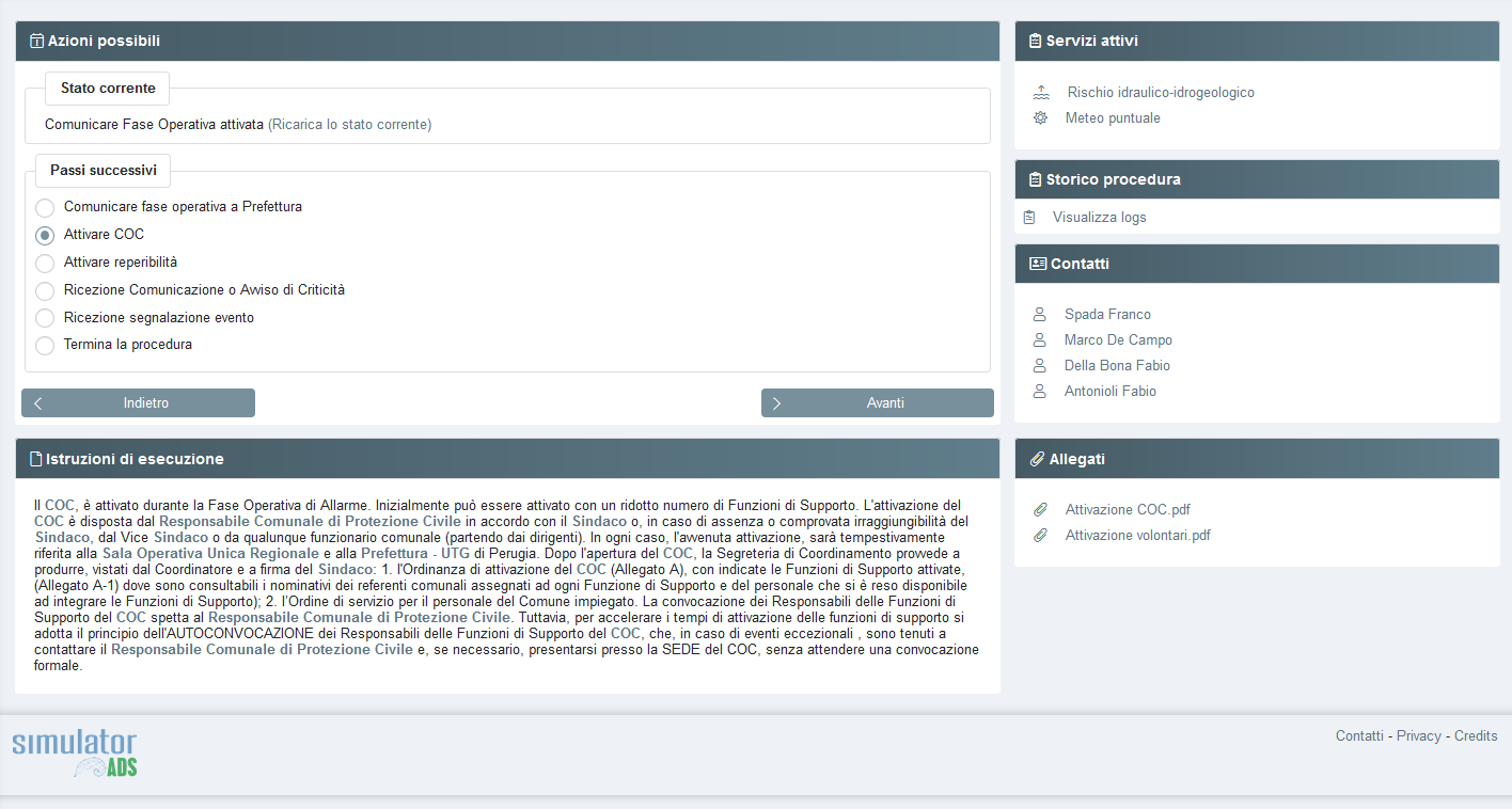
The platform allows you to monitor and manage the status of operations in real time, offering a clear and up-to-date overview of the active operational phases. Thanks to an intuitive interface, users can quickly access the available actions and select the necessary next steps, such as activating specific protocols or managing event reports. This system supports local decision-makers in the decision-making process, through centralised management and continuous integration of up-to-date data, thus optimising the effectiveness of interventions.
Are you interested in discovering how SIMULATOR-ADS can aid in risk management, risk assessment, and land protection?
Contact us for a custom demo or more information about the platform.
👉 Request a demo
👉 Write to us at: info@terraria.com