System for monitoring the variation in environmental indicators related to atmospheric constituents and energy dispersion
The SINOPIAE project was created in response to the Lombardy Region’s call for Industrial Research and Prototype Development projects in strategic sectors. SINOPIAE is a multi-source system that integrates satellite, aircraft and ground-based multispectral observation techniques for multi-scale monitoring of variation in environmental indicators related to atmospheric constituents and energy dispersion.
The system examines regional-scale weather-climate processes induced by anthropogenic activities, through the implementation of modules for assessments: ‘of the effects of atmospheric pollution (gases and aerosols) at the regional scale and on sparsely anthropized environments such as lakes and glaciers; of energy dispersion; of the direct effects of aerosols on the radiation budget of the surface-atmosphere system at the regional scale; and of the interaction of emission scenarios of air pollutants and energy in urban environments, through the use of models that consider meteorology, transport and dispersion, and the chemistry of pollutants and their interaction with radiative aspects.
The results of the SINOPIAE project are HW Products – related to the flight segment and SW Products – software modules. The SW products are divided into six different modules: inland water indicators, glacier indicators, urban environment heat loss, direct AEROSOL effects, base case and energy-emission scenario modeling, and satellite atmosphere data.
Within the project, emission and energy scenarios were defined and calculated for the summer and winter period and at 6×6 km spatial resolution. These scenarios were the input that enabled the implementation of WRF-Chem and its application at two different scales of detail (Lombardy and Milan Metropolitan Area).
THE ROLE OF TERRARIA
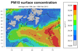
TerrAria was responsible for the implementation of the modeling chain and designed and built a web application for visualizing the outputs of simulations performed through the WRF-Chem model. The goal pursued was to create a visualizer of static maps of weather and air quality variables.


