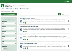
Online access point to the information assets of the regional spatial infrastructure
TerrAria oversaw the design and development of the Geoportal of Lombardy, which is the online access point to the information assets of the regional spatial infrastructure.
The realized system is a tool aimed at citizens and professionals, which provides various services, such as:
- the consultation of maps through diversified access points;
- the consultation of various geographic data using the viewer, which also allows location by address;
- the search for available geographic data, organized in a catalog (according to ISO standards) containing their technical characteristics, processing methods, and responsible parties, and interactively linked with both the viewer and the download service;
- the transformation of the cartographic reference system of spatial data;
- the download through which to download free vector data or raster format maps.
The system architecture is based on the use of two frameworks:
- the Liferay Portal platform, for front-end management to users, a portal framework that enables the integration of content, services and applications through a centralized layer and through integration methods including REST services, proprietary APIs
- ESRI’s Geoportal Server for managing geographic metadata using RNDT2.0 standards.
Client: Lombardia Informatica spa
Contact person: Lombardy Region
Year of execution: 2014 – ongoing
Link: http://www.geoportale.regione.lombardia.it

