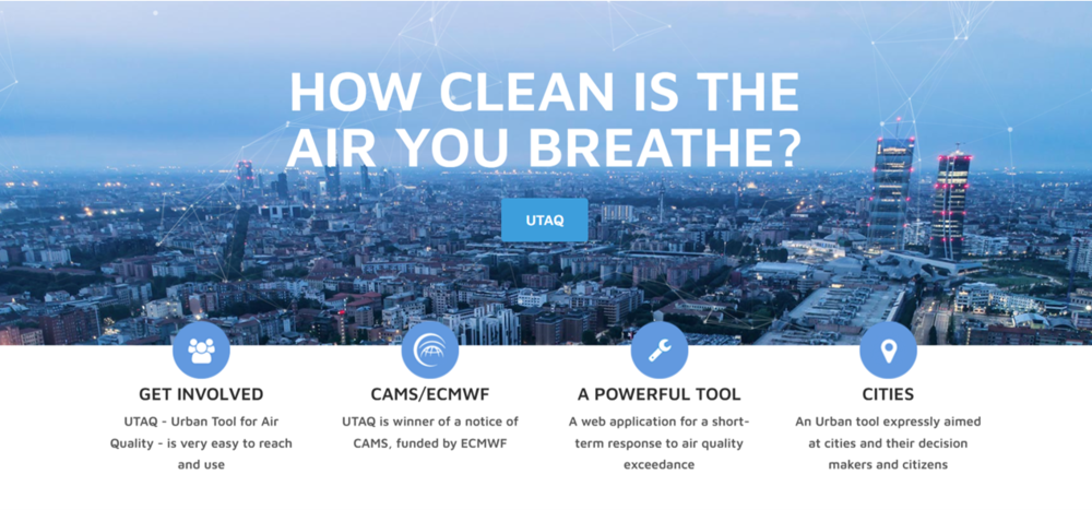
UTAQ (Urban Tool for Air Quality) is a web application for urban-scale air quality assessment, developed in the European Centre for Medium-Range Weather Forecasts (ECMWF)-funded project of the same name.
The application and project are in the context of reducing pollutant concentrations in line with European policies. The EU air quality standards adopted by the Member States in 2008 (2008/50/EC) define a short-term action plan which each Member State draws up indicating the measures to be taken in the short term in order to reduce the risk or the duration of such exceedances of concentration limits for the main pollutants affecting urban areas, as nitrogen dioxide (NO2) and particulate matter (PM10 and PM25).
This approach aims to protect the population from peak concentrations and promotes the prevention of severe episodes through the implementation of air quality forecasting systems. In order to comply with the short-term limit values set by legislation and to reduce dangerous concentration levels, emission abatement actions must be planned at least one or two days in advance. In addition, according to EU directives, local authorities must provide information to the public on the state of air quality and its foreseeable development for the following days.
TerrAria with the UTAQ project has responded to these needs and at the same time satisfied the request of the CAMS calls that requested the configuration and demonstration of downstream applications using one or more CAMS products as input, also called “Use Cases”. UTAQ was also used for the assessment of traffic scenarios in the Urban Plan for Sustainable Mobility of the Metropolitan City of Turin and for the Urban Plan for Sustainable Logistics of the Metropolitan City of Florence.
Product functionality
UTAQ allows urban planners and municipal agencies to have an estimate of the air quality in their urban areas and evaluate the short-term response to manage emergency conditions in case of exceedances of the reference values.
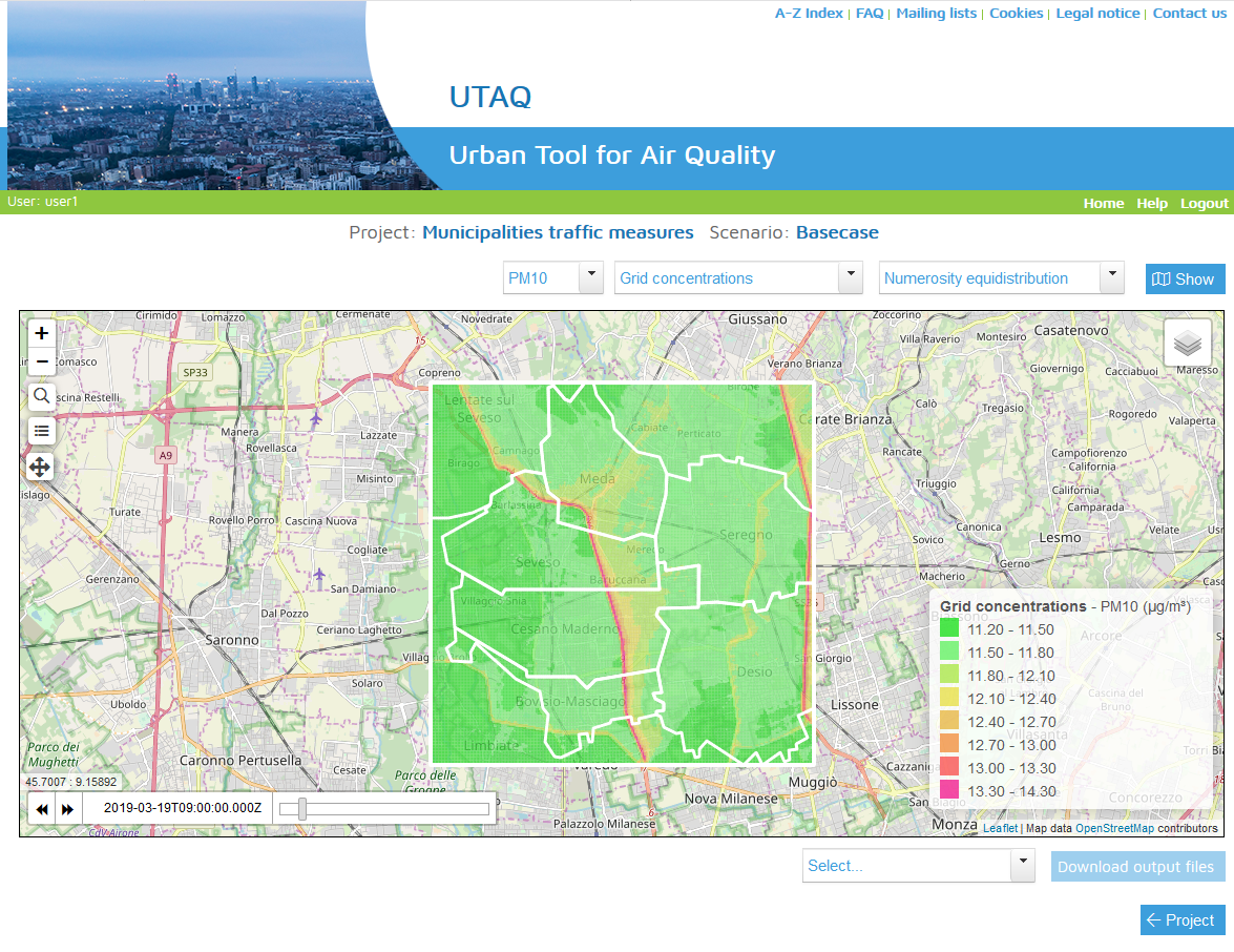
To support decision makers in the public administration, the new UTAQ tool produces high-resolution air quality maps of the current situation and forecasts for the next 4 days. These are high resolution maps of total emissions and average concentrations for urban areas.
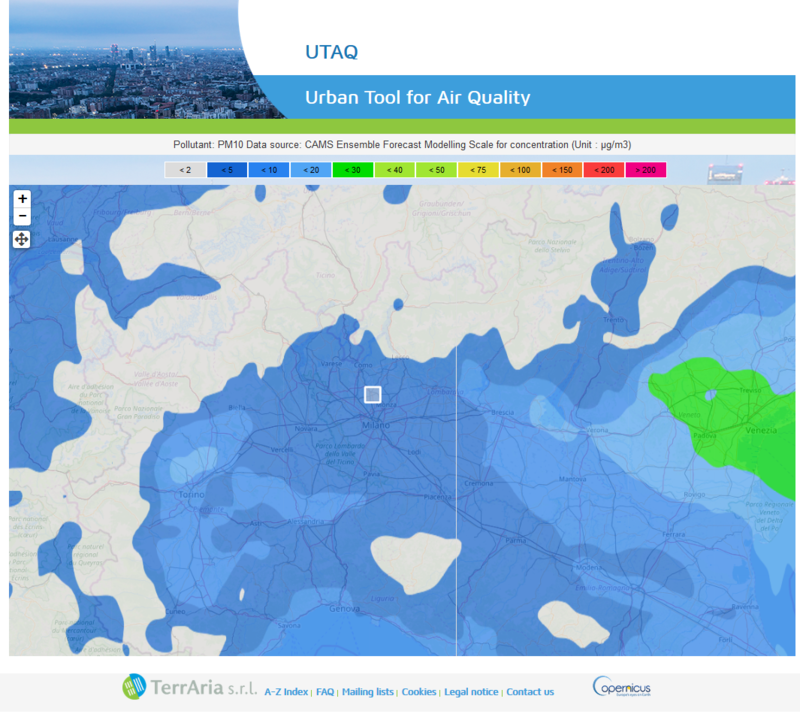
UTAQ uses air quality data provided by the Copernicus Atmosphere Monitoring Service (CAMS) as background concentrations.
UTAQ is also a mobile App that helps authorities to communicate urban strategies adopted and air quality forecasts to the inhabitants of the city and contributes to prevent exposure to peak pollution for “sensitive” citizens (e.g. children, asthmatics…) providing them with the spatial and temporal variation of air quality based either on their location (via GPS) or desired route (i.e. find out the least polluted journey).
UTAQ has been tested by AMAT (Agenzia Mobilità Ambiente e Territorio), ATS Milano and ATS Val Padana in the framework of studies conducted on the area of the Metropolitan City of Milan (https://www.amat-mi.it/it/notizie/33/) and of the Municipality of Milan as well as in the provinces of Lodi and Mantova. The tool has also been tested by ARPAE in the cities of Rimini and Bologna, and applied in the Metropolitan City of Turin to support the PUMS (Urban Plan for Sustainable Mobility). At the European level, UTAQ has also been tested in the city of Barcelona, confirming its adaptability to different territorial and regulatory contexts.
The UTAQ platform allows you to view the concentrations of PM10, PM2.5, NO2 and NOX expected in the next few days, using background data provided by the European service CAMS. High resolution maps enable public decision-makers to quickly identify critical areas and plan targeted interventions for the protection of citizens’ health.
Through UTAQ, it is possible to analyse in detail the distribution of pollutant concentrations within individual municipalities, assessing the effectiveness of the measures adopted and supporting communication to citizens. The tool provides a clear and up-to-date view of air quality, which is crucial for emergency management and sustainable urban planning.
Interested in monitoring air quality in your city with UTAQ?
Contact us for a custom demo and find out how our platform can help you assess and manage urban air quality, especially in emergency situations.
👉 Request a demo
👉 Write to us at info@terraria.com