Vegetation Index Geographic Information System
Starting from the need of Corteva Agriscience (first Pioneer Hi-Bred Italy) to optimize the activity of its technicians and agronomists, TerrAria developed for them, starting in 2016, a customized platform called ViGIS (Vegetation Index Geographic Information System). This is a tool that assists technicians throughout the life cycle of different crops, allowing the identification of any critical issues, such as areas under greater stress that need priority intervention, thanks to the use of satellite data that allow frequent monitoring of agricultural fields in the system.
THE PLATFORM
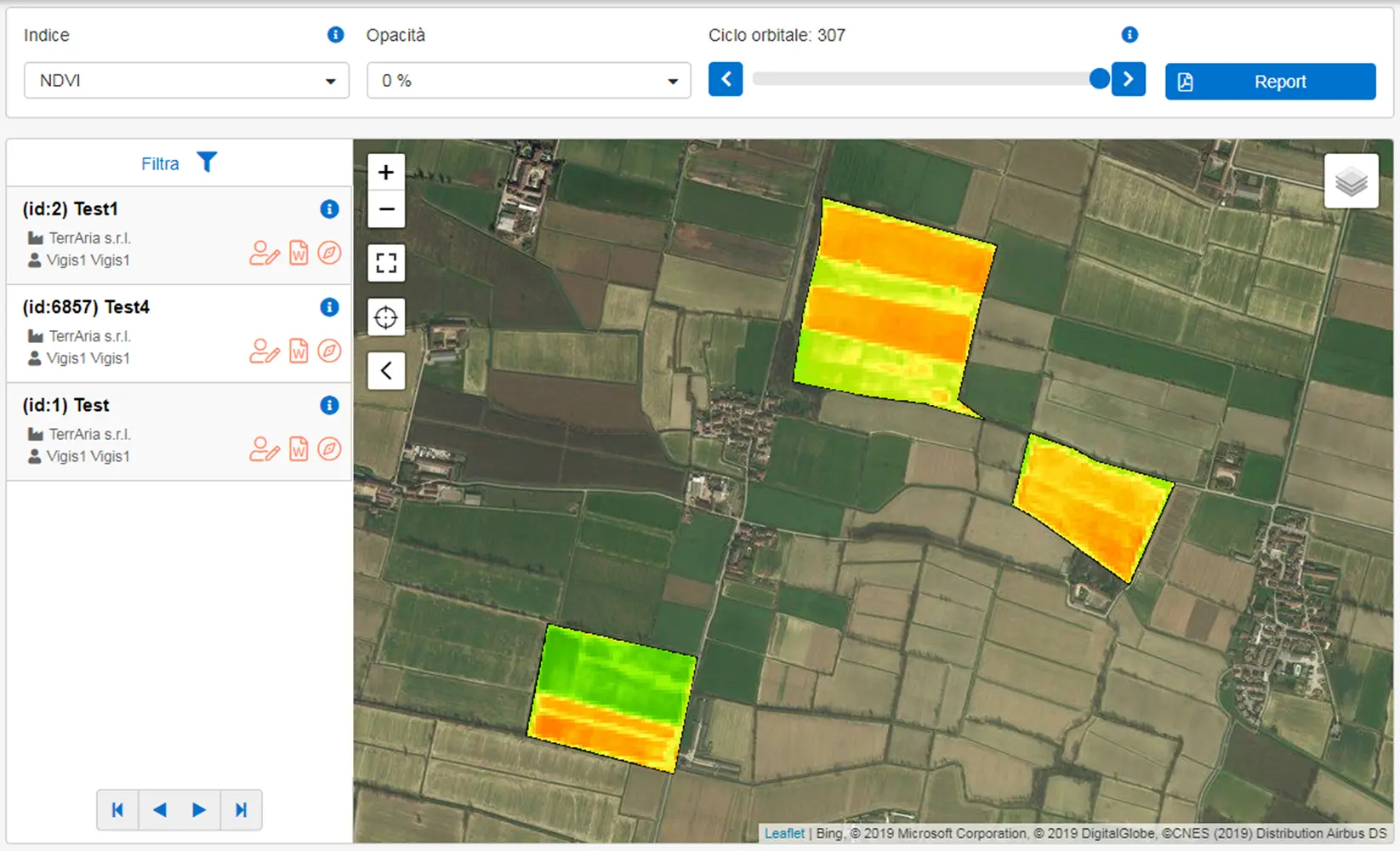
ViGIS is a downstream service platform of the European Union’s Earth observation and monitoring program called Copernicus that uses data from the Sentinel-2 mission, from which various spectral indices are calculated and mapped to assess, for example, vegetative vigorvigour and water content (NDVI indices, NDWI, etc.). The maps produced with each new pass of the satellites allow the temporal trend of the indices to be evaluated and also can be queried by the user to know the index trend at each individual point throughout the growing season. With respect to these maps, reports are also available showing statistics for each orbital cycle available over the specified time interval.
In addition, ViGIS makes it possible to use soil test data, sampled in situ and processed by the testing laboratory, to draw up fertilization plans that consider soil endowments, crop removals, and the quantity and quality of livestock manure distributed on the plots. The fertilization advice can be exported in the format useful for variable-rate manure distribution. Hybrid-specific maps for corn seeding can also be drawn up through the service and the information exported in digital format for variable rate seeding. In order to identify where to take soil samples, it is also possible to set up sampling grids to identify the location of cores according to any critical issues on the map. Finally, soil test results can be consulted on the map and yield and electrical conductivity maps of agricultural fields can be viewed, queried and evaluated.
Client: Pioneer Hi-Bred Italy
Year of execution: 2016 – ongoing