Noise assessment tool for agglomerations
Strategic Noise Mapping is the representation of data on an existing or predicted noise situation in an area, relative to a given source, as a function of a noise descriptor. The noise descriptor indicates the exceeding of existing limits, the number of people exposed in a certain area, or the number of dwellings exposed to certain values in a certain area. As stated in Legislative Decree 194/2005, the Strategic Noise Map is aimed at determining the overall noise exposure in a certain area due to various sources. The next due date for submission of this document is June 30, 2027, and it must be reviewed or revised every 5 years. The entities that must comply with the implementation of the Mapping are agglomerations with more than 250’000 inhabitants, companies and entities operating public transport services with road axes on which more than 3’000’000 vehicles pass annually, rail axes on which more than 60’000 convoys pass annually, and major airports. If the relevant entities fail to comply with the mapping, the Decree provides for penalties ranging from 30’000€ to 180’000€ for each month of delay.
CUSTOMERS
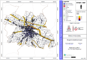
With respect to the last round of Strategic Acoustic Mapping presentations, TerrAria has joined the Reggio Emilia Agglomeration by integrating contributions from road infrastructure under the jurisdiction of the municipality, the province, ANAS and the rail network.

